— by Mike Bates —
LiDAR stands for Light Detection and Ranging. The survey technique uses laser scanners mounted to light aircraft to send thousands of pulses to the ground to record and measure the height of the ground surface with a very high resolution and accuracy. Even the smallest of height differences on the surface of the landscape are recorded, resulting in a map of the ground surface in incredible detail. Using the new Portal volunteers have been able to navigate the area map, zoom in, and help us discover new archaeological sites.
Volunteers have received free specialist training in how to recognise and interpret archaeological features on LiDAR images to help digitally record unmapped archaeology. The Portal also hosts historic maps, aerial photographs and information on known archaeological records and gives everyone the opportunity to explore the archaeological wonder of this amazing landscape.
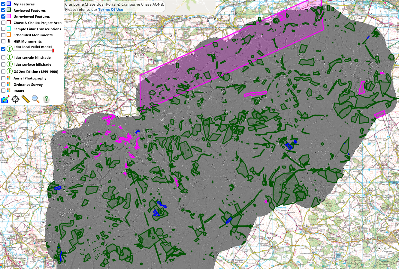
The Portal Map Image to the right shows the area the Project focuses on, from south-west of Wilton and Salisbury down to north-east of Blandford Forum. The Blue areas are ‘My Features’ that one has recorded oneself; pink areas are what others have entered; green features are both the previous categories but have been ‘reviewed’ by the project team.
What are we looking for?
We are looking for a range of archaeological feature types that may have physical remains in the landscape. These include
- There are many hundreds of Barrows, of which many are ploughed out.
Types are:
– Long Barrows – Neolithic (New Stone Age),
– Round Barrows – Early Bronze Age,
– Disk Barrows – lower Profile (maybe later ones, often with grave goods such as beads). - Tumulus – a mound, which when marked on a Map can mean
– just a mound,
– a Way marker,
– a Barrow.
- Dykes and Entrenchments.
- Ancient Field Systems, including Lynchets (terraced fields on hillsides).
- Roman Roads, Roman Works, Roman Villas (can be grand or basic farmsteads)
- Causeway Henges (early), Henges, Standing Stones
These features of interest need to be unpicked from a landscape that also contains evidence of activity from modern periods.
How do we find and record a feature?
On the LiDAR Portal we can switch our back ground map to show:
- LiDAR visualisations
- Ordnance Survey Historic Mapping (2nd Edition 1899-1900)
- Aerial photograhy
- Modern Ordnance Survey 1:25,000 mapping
We can also add the following data to the Map:
- Scheduled Monuments (Historic England),
- HER Monuments/Features (Historic Environment Record).
and from items shown on these layers we can access their actual records on the internet. We can also search on the internet for articles, PhD Theses, Geophysical surveys, etc.
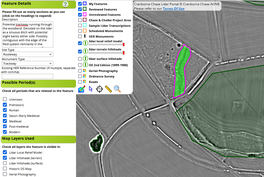
To record a feature we draw a box round the area of interest and enter the details we have found in a structured way.