Resource List
To help our volunteer community access supporting information we have collated a list of useful resources. This will be added to as the project progresses so please email Rebecca with any suggestions.
Archaeology of the Chase Resources
The following resources provide a grounding in the archaeology of the Chase (our understanding of which will of course be enhanced with your contributions to mapping features from the LiDAR!).
Books
Barrett, John C., Richard Bradley, and Martin Green. Landscape, Monuments, and Society : The Prehistory of Cranborne Chase. Cambridge [England] ; New York: Cambridge UP, 1991.
Barrett, John, Richard Bradley, and Melanie. Hall. Papers on the Prehistoric Archaeology of Cranborne Chase. Oxford: Oxbow, 1991. Print. Oxbow Monograph ; 11.
Green, Martin, and Michael J. Allen. A Landscape Revealed : 10,000 Years on a Chalkland Farm. Stroud: Tempus, 2000. Print.
Sumner, George Heywood M. The Ancient Earthworks of Cranborne Chase (described by H. Sumner). Lond, 1913. Print.
Other Media
This presentation was given by Phil Planel for the Chase & Chalke Talks: Spring Series 2021. exploration of how the great archaeologists that have made their names on and around Cranborne Chase were inspired by the landscape around them and how we, in turn, in a different age can also be inspired by the landscapes around us.
Interview with Martin Green of Down Farm, a farmer and archaeologist, who has spent decades investigating and excavation the incredible archaeology on his farm. He speaks specifically about how his farming knowledge helped him to understand a “dubious cropmark” (no spoilers here you’ll have to listen in!).
Chalk Landscape Aerial Archaeology Projects
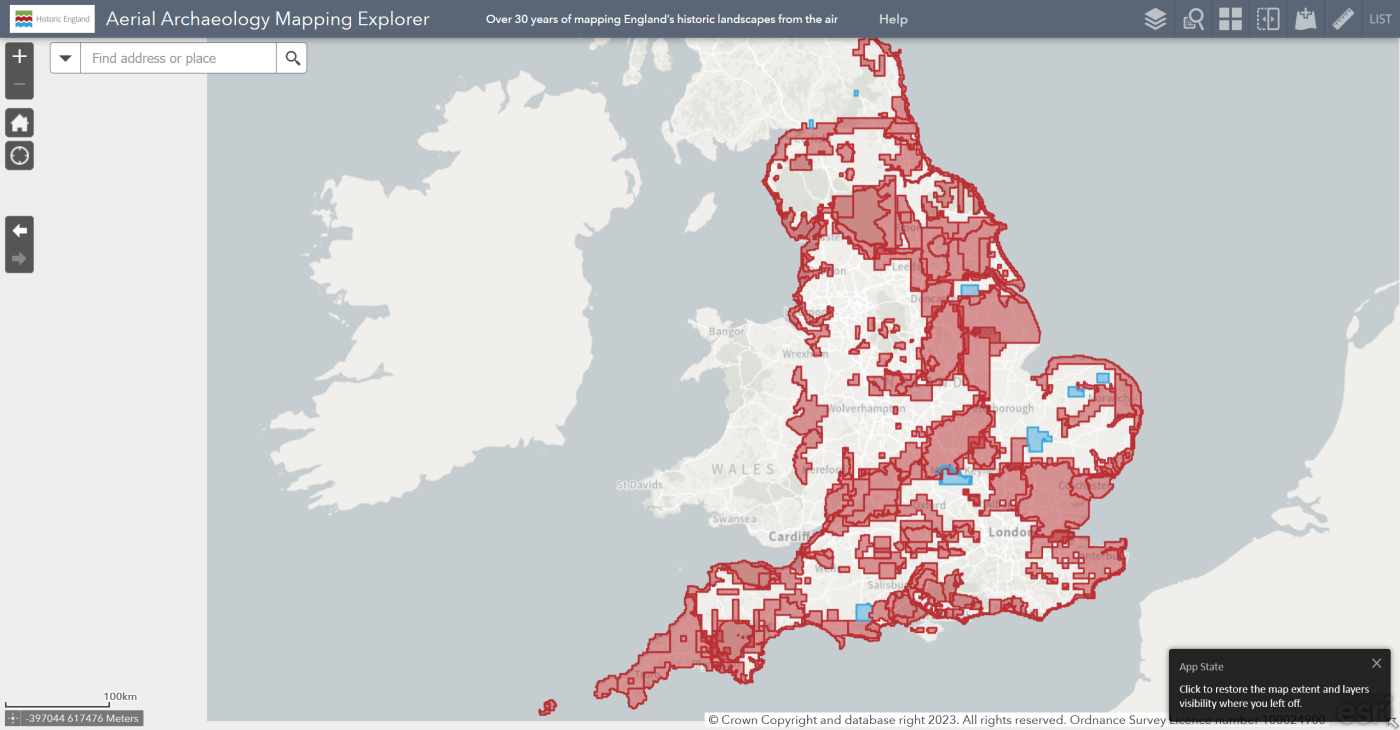
The results of these projects can be viewed on the Historic England Aerial Archaeology Mapping Explorer which shows the mapping of archaeological features and provides textual information for all monuments that have been identified using aerial photographs and LiDAR by Historic England projects (also known as the National Mapping Programme).
Secrets of the High Woods
Host Organisation: South Downs National Park
Area: chalk downs north of Chichester
Historic England Project Report Secrets of the High Woods
Changing Chalk
Host Organisation: National Trust,
Area: chalk downs north of Brighton
Historic England Project Report Changing Chalk – Downs from Above
Chilterns Beacons
Host Organisation: Chilterns AONB (2018-2023)
Area: Chilterns ANOB
Archaeological Feature Descriptions Videos (High Weald AONB)
GIS, Map and Database Resources
The following resources were collated by the Beacons of the Past Project, A citizen Science project in the Chilterns AONB which ran from 2018-2022.
Satellite/Aerial Images
- Google Earth https://earth.google.com/web/ historic images (back to 1940s) can be viewed in the desktop version
- Aerofilms collection 1919-2006 (aerial photographs pooled from various national collections) https://britainfromabove.org.uk/en/map?country=global&view=map#0,262466.52493474324,609599.6708161779
- National Collection of Aerial Photography https://ncap.org.uk/search?view=map
- Cambridge air photos collection https://www.cambridgeairphotos.com/map/
- Historic England Repton and Capability Brown managed landscapes https://services.historicengland.org.uk/designed-landscapes-map/index.html
- Historic England recently launched their aerial photography portal https://historicengland.maps.arcgis.com/apps/webappviewer/index.html?id=2626ed0c37484d96b8954dd33187084e
Geology & Soils
- British Geological Survey (map interface to superficial and bedrock geology) http://mapapps.bgs.ac.uk/geologyofbritain/home.html
- Also BGS – UK Soil Observatory data on soil types, profiles, thicknesses, chemistry etc. http://mapapps2.bgs.ac.uk/ukso/home.html
Historic Maps
- National Library of Scotland (map interface to historic OS maps as far back as 1840s) https://maps.nls.uk
- Ordnance Survey Drawings (“OSDs” dating to c. 1810-1820). On Wikimedia Commons: https://commons.wikimedia.org/wiki/Category:Ordnance_Survey_Drawings
- Vision of Britain Through Time – 1st series OS 1 inch to the mile maps (dating to the 1830s-1850s): http://www.visionofbritain.org.uk/maps/series?xCenter=3160000&yCenter=3160000&scale=63360&viewScale=5805357.4656&mapLayer=nineteenth&subLayer=first_edition&title=Ordnance%20Survey%20and%20Ordnance%20Survey%20of%20Scotland%20First%20Series&download=true
Historic Boundaries
- Domesday Shires and Hundreds (downloadable as GIS shape files) https://archaeologydataservice.ac.uk/archives/view/domesday_lt_2020/
- Pre 1850 Parish boundaries (downloadable as GIS shape files, but not that accurate. Registration is required, but can be done as an Independent Researcher) https://beta.ukdataservice.ac.uk/datacatalogue/studies/study?id=4828
- Pre 1850 Parish boundaries (downloadable as a set of pdf maps, less convenient but more accurate than the GIS versions, Registration is required) https://beta.ukdataservice.ac.uk/datacatalogue/studies/study?id=4348
Historic Environment Record
- Heritage Gateway (database search access to multiple databases including Historic England and County records) https://www.heritagegateway.org.uk/Gateway/
- Know Your Place – Wiltshire Know Your Place – Wiltshire (bristol.gov.uk) tithe maps and apportionments, HER data, map overlays/comparison
- Dorset Explorer, Aerial Photographs, historical maps and HER data DorsetExplorer (dorsetcouncil.gov.uk)
- Portable Antiquities Scheme (database of recorded finds) https://finds.org.uk/
- National Trust https://heritagerecords.nationaltrust.org.uk/map
- Historic England Aerial Archaeological Mapping Explorer (mapping of archaeological features identified from aerial sources) https://historicengland.maps.arcgis.com/apps/webappviewer/index.html?id=d45dabecef5541f18255e12e5cd5f85a
GIS Heritage Projects
- Atlas of Hillforts of Britain and Ireland https://hillforts.arch.ox.ac.uk/
- The Rural Settlement of Roman Britain https://archaeologydataservice.ac.uk/archives/view/romangl/map.html
- English Landscape and Identities Project (1km grid of Bronze Age to Domesday Book archaeological records) https://englaid.arch.ox.ac.uk/
- Deserted Medieval Villages (based on Beresford) https://dmv.hull.ac.uk/ukMap.cfm
- Natural England GIS data sources (environmental data sources) https://magic.defra.gov.uk/
Public Rights of Way (these are the published legal records to PRW, but many ancient rights of way may show up in the LiDAR data which are not recorded)
- Definitive rights of way http://www.rowmaps.com/
Other documentary sources
- Institute of Historical Research (includes access to British History Online) – Victoria County History (founded in 1899 to document Parish histories) https://www.history.ac.uk/research/victoria-county-history
- Medieval Documents register – if you want to investigate manorial history or look into the Victorian transcripts of pipe and charter rolls I’ve recently (Nov 2021) discovered this comprehensive inventory of medieval documents mostly available online http://www.medievalgenealogy.org.uk/index.html
Public Utility infrastructure (linear features in the LiDAR data are not always archaeological – these are links to GIS shapefiles)
- Gas pipelines: (copyright) National Grid UK – high pressure transmission (not distribution) gas pipeline shapefiles (low resolution maps also available), published May 2018 https://www.nationalgridgas.com/land-and-assets/network-route-maps
- Electricity: (copyright) National Grid UK – power cable and overhead line transmission (not distribution) shapefiles, published August 2019 https://www.nationalgridet.com/network-and-assets/network-route-maps
- Water: equivalent pipeline maps and data do not seem to be available
Why is it
important?
LiDAR is just the starting point – there’s so much to learn and discover about our historic landscapes and how people lived in the past.
Get involved
The Cranborne Chase LiDAR portal was developed as part of the Chase & Chalke project ‘Champions of the Past’, a major archaeological project which aims to provide opportunities for people to learn about and engage with archaeology.
To find out more about the project and Chase & Chalke, click below.