Find out more about LiDAR
Using modern technology to investigate historic landscapes
In April 2020 LiDAR data was acquired for 351km2 of the the Chase & Chalke Valley project area. This landscape has a rich history of human activity which can be traced using the digital models created from the LiDAR survey.
Airborne LiDAR is a survey method that allows us to make highly accurate 3D models of the ground surface. These models show traces of human activity that help us to understand how communities use the landscape in the present and the past.
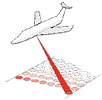
A LiDAR sensor uses a laser to measure the distance between the aircraft and the ground. By recording millions of these measurements we can create a record of the relative heights of the ground surface. The laser also reflects off trees and buildings, cars, cows and cursus monuments – anything present in the landscape at the time of the survey is recorded. This means that the models must be interpreted by humans to make sense of the information they contain.
The LiDAR models have been processed into a series of images that help us to make sense of the topography. The images used in the portal are described below.
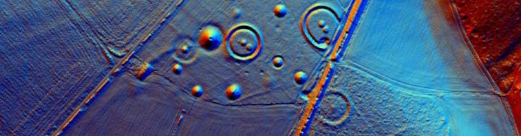
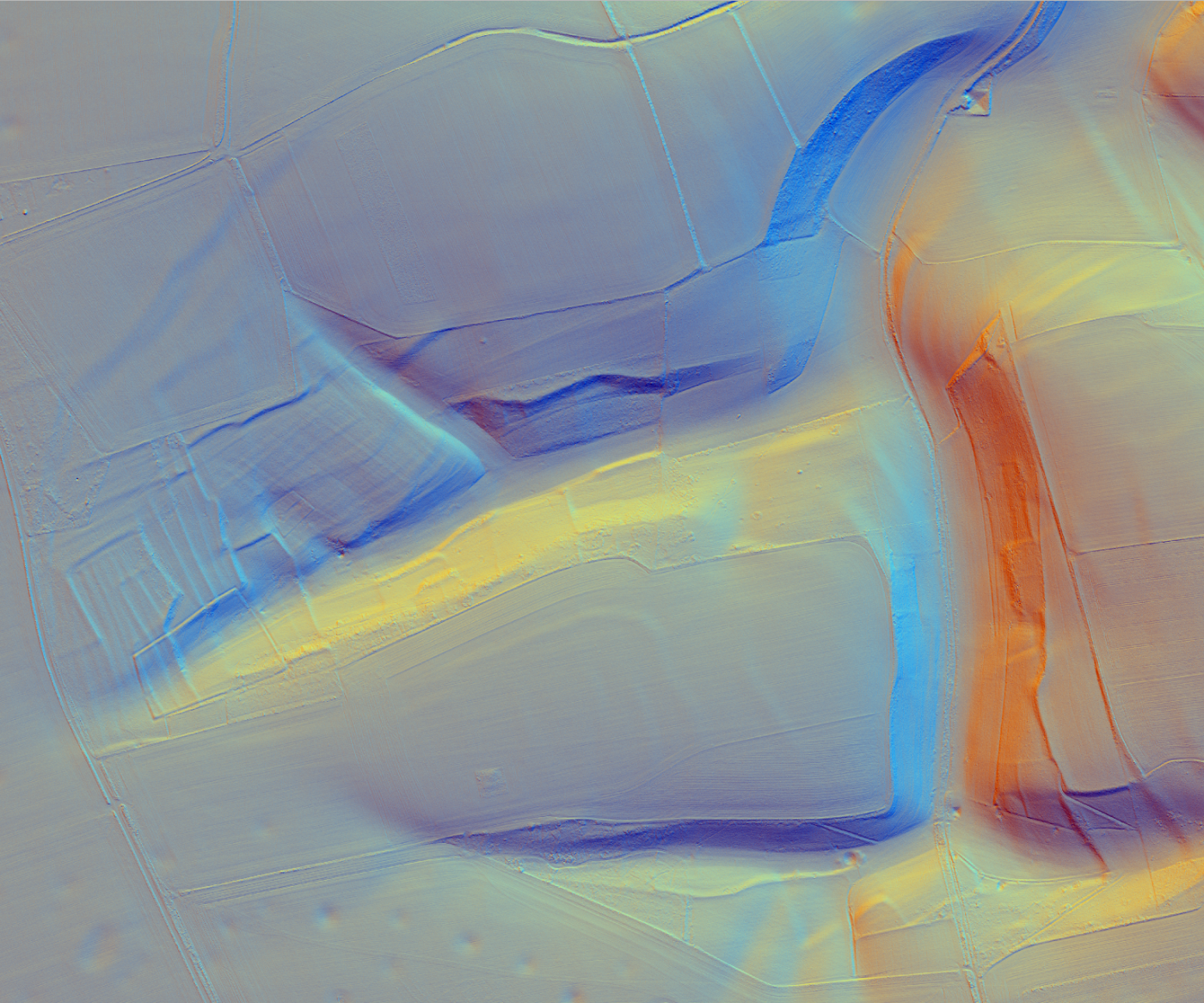
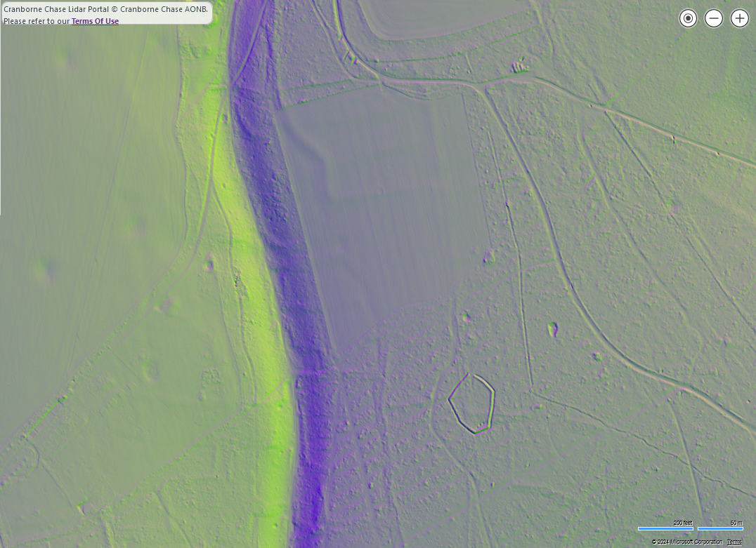
Multi-direction hillshades of the surface model (containing all vegetation and buildings) and the terrain model (just the ground surface with all vegetation and buildings digitally removed). A multi-direction hillshade combines the modelled illumination from three sun directions to make a colour image to assess both big changes in the landscape like hills and valleys ( known as macro-topography) and small changes that can represent human actions over the centuries (known as microtopography).
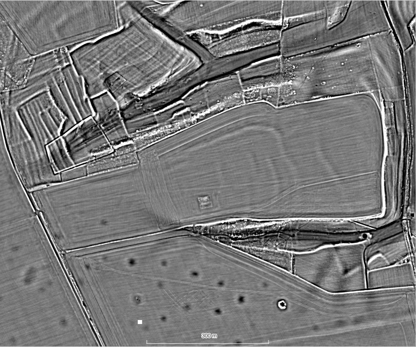
Local Relief Model (LRM) of the terrain data accentuates small scale changes in a clear image where positive features (banks, boundaries) are white and negative features (ditches, pits) are dark. This image is particularly suited to identifying subtle archaeological features.

If you’d like to learn more about how LiDAR data is collected and processed why not sign up as a volunteer to take our training course?
Cranborne Chase LiDAR Portal
The data captured during the survey are processed into high-resolution (25cm) models of the land surface that allow for the small physical traces left by past communities to be mapped. Features such as banks, ditches, pits, mounds can be identified even when they are covered by vegetation.
LiDAR survey has been revolutionary to our understanding of past human activity due to landscape-wide scale and holistic nature of the data captured. There have been many examples of LiDAR for archaeology over the last two decades but this project is the first time that the unique archaeological landscape of Cranborne Chase has been surveyed at such a high resolution.
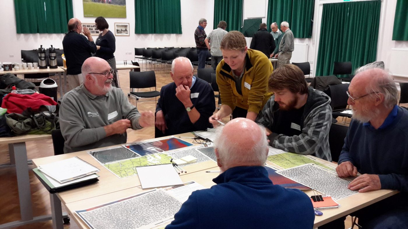
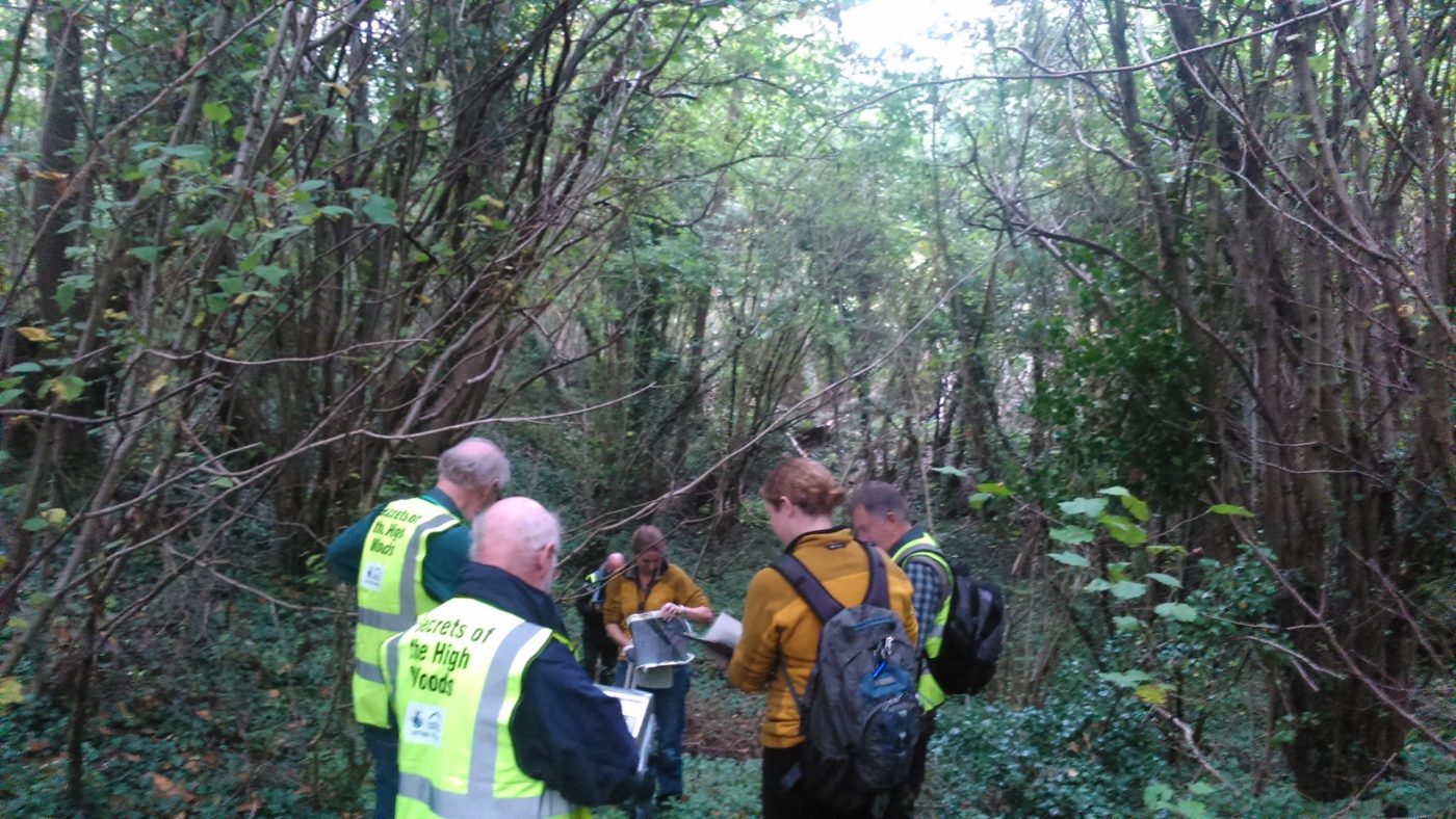
However the wealth of information in the LiDAR models needs to be captured and interpreted to be of real use to anyone wanting to understand the landscape and this is where our amazing volunteer citizen scientists step in. The Chase and Chalke project have created a LiDAR portal and learning materials to help anyone access this incredible resource. In return, you can contribute to the creation of a lasting legacy of archaeological information by mapping potential sites on the portal and joining our field surveyors to assess them on the ground. The information gathered for this project will allow us to better manage and protect this special historic landscape for future generations to enjoy and explore. The first wave of mapping has now been completed but through 2024 and 2025 we will be undertaking several more detailed projects using the LiDAR portal so there is still time to join in!
Why is it
important?
While we have hundreds of archaeological records for Cranborne Chase, many thousands more sites remain unrecorded. The traces of past human use of the land such as ancient fields and settlements can be hard to appreciate on the ground. Using LiDAR survey brings a new perspective on the landscape and helps us to identify, monitor the condition and better manage new and existing archaeological remains. LiDAR can really help in our understanding and appreciation of this archaeology through incredible levels of detail and robust, innovative 3D modelling.
Get involved
The Cranborne Chase LiDAR portal was developed as part of the Chase & Chalke project ‘Champions of the Past’, a major archaeological project which aims to provide opportunities for people to learn about and engage with archaeology.
To find out more about the project and Chase & Chalke, click below.