— report by Michael J Allen —
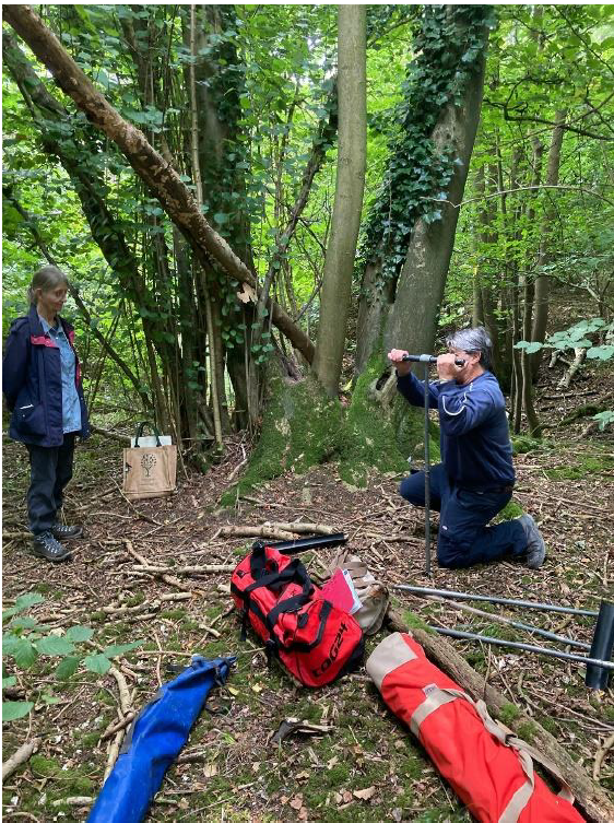
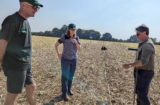
In August 2024 the Chase Chalke volunteers joined Mike Allen to undertake two days of hand augering to define the nature, character and potentially depth of the infill of two pits in the environs of Netton Clump. The pits were chosen as they represented two different landuses, woodland and ploughed arable field so that the impact of these on the form of the pits could be examined. The following is extracted from Mike Allen’s report and presentation to the volunteer group. The full report can be read here Preliminary Geoarchaeology of the Netton Clump Depressions.
Preparation
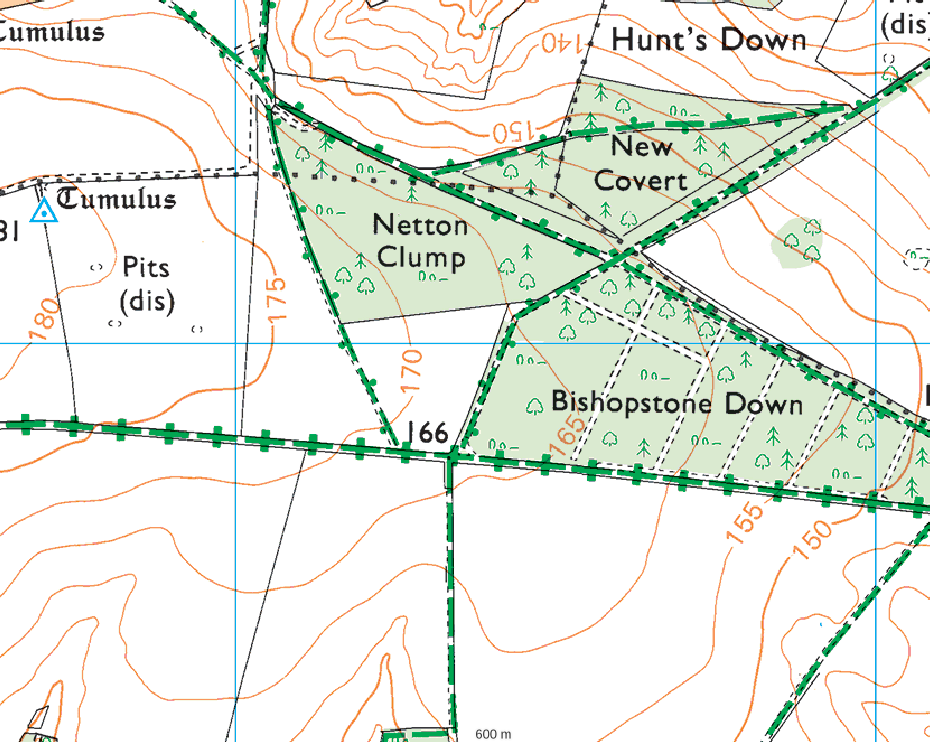
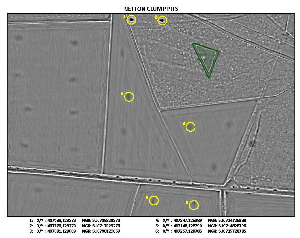
A walkover survey was conducted and initial test augering to demonstrate the negligible intervention and lack of damage to any tree roots, and to the Chase and Chalke, LP Scheme Manager (Robert Lloyd), and some the volunteers, the viability of augering. The walkover survey examined four features; two in Netton Clump itself (1 & 2) and two in the adjacent arable field (3 & 4). Preliminary test augering in three of these revealed deposits in all. Two were selected for more detailed augering with a team of volunteers: feature1 within Netton Wood, and feature 3 in the adjacent arable field. The pits were also measured and planned to scale to support analysis.
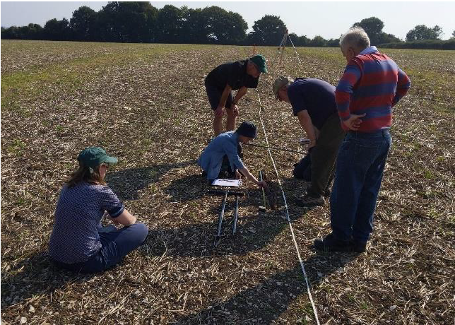
Augering and level survey underway at the two pit locations
Results
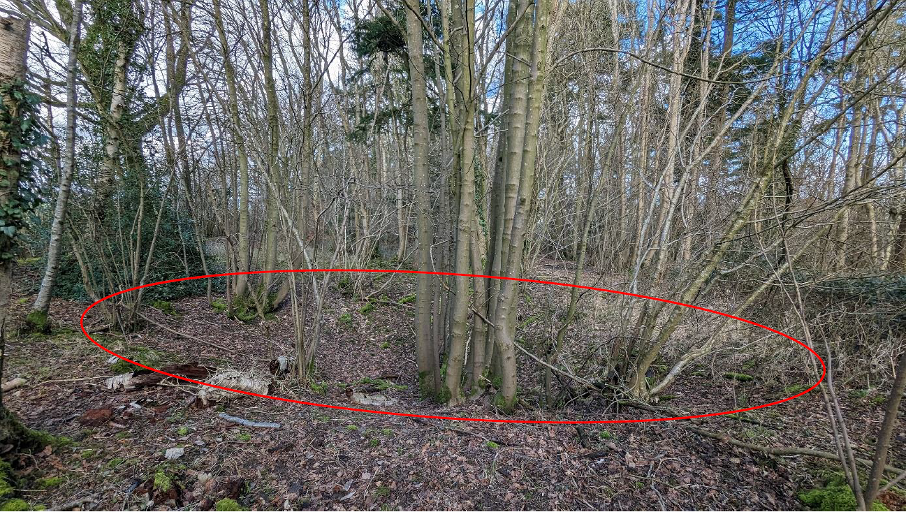
Feature 1
The feature was oval and approximately 12m (E-W) 9m (N-S) steep-sided and about 1 to 1.55m deep (Figs 1, 7, 9 7 10; Appendix 1). A number of flint nodules had rolled in to the base and lay amongst the leaf litter. A north-south transect line was set out across the feature and 4 auger holes recorded; two on the lip or land adjacent to the depression and two in its base (Appendix 2). On its edges the woodland soil was a thin (c. 30cm) azonal rendzinaform humic soil over chalk to the north and Clay-with-Flints to the south. Neither of the two auger holes in the base were bottomed due the presence of flints, but were 0.4m and 0.6m deep and encountered deposits presumed to be derived from Clay-with Flints
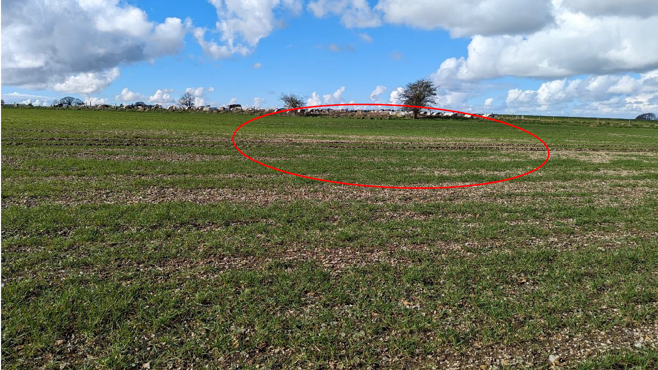
Feature 3
more detailed auger survey was undertaken of this very shallow (max 0.44m) c. 25m diameter depression in the ploughed field west of feature 1 (Fig. 8). A series of 7 auger points were conducted along over a distance of 33.5m along the N-S orientated transect (Appendix 3). The plough soil at the ends of the transect were 0.35m thick over chalk to the north (at 1.25m) and 0.42m thick of weathered Clay-with-Flints over chalk to the south (at 34.7m). The fill on the inner edges overlay weathered chalk to 0.4m and 0.6m depth. The inner two auger points (at 8.7m and 22m) revealed a clay-with-flints derived material to a depth of greater than 1.4m; the flinty nature prevented hand augering further.
The augering refined the present distribution of Clay-with-Flints over the chalk showing it to be much reduced by ploughing and almost total removed from the area of F3 and F4. The augering is not conclusive, but shape and character of the features and the presence of Clay-with-Flints derived deposits and of flinty, stony fills tends to suggest that this is remnant of either backfill or weathered material into an open pit. As such, although this could be fills such as those in the doles at Fir Tree Field, the evidence tends to suggest an anthropogenic origin, probably quarries. The fact the better preserved feature in the woods are oval, and have a possible entrance also tends to support this hypothesis. The augering has assisted in characterising the features and also helps also toward a tentative interpretation.