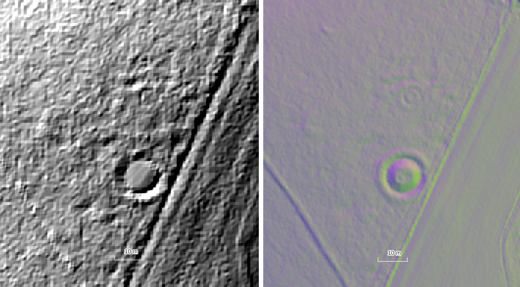
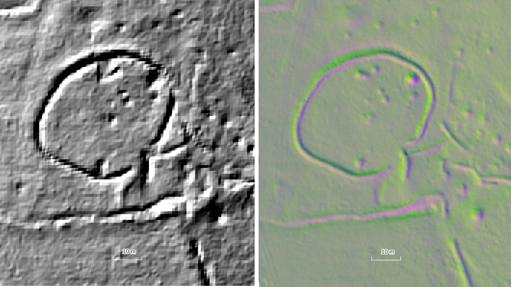
When using lidar data you should be aware of its resolution, i.e. what one pixel on the image represents as a distance in the real world.
The resolution of the data is really important as it caps our expectations of what archaeology we might reasonably see. To identify any feature in airborne data there is a rule of thumb that states in needs to be three times the resolution of the data (in any direction) for the feature to be confidently identified.
So if you have lidar data of 1m resolution the smallest feature you should confidently identify would be 3m and larger. For higher resolution lidar like the Chase and Chalke data which is 0.25m (25cm) resolution, you should expect to see features measuring 0.75m (75cm) and above in any direction.
As you can imagine, a lot of extra detail is captured by 25cm resolution lidar data compared with 1m data, especially in wooded areas, and this is why higher resolution data are preferred for historic environment assessments.
Take a look at the examples below to compare the Chase and Chalke 0.25m data and the Environment Agency 1m data.