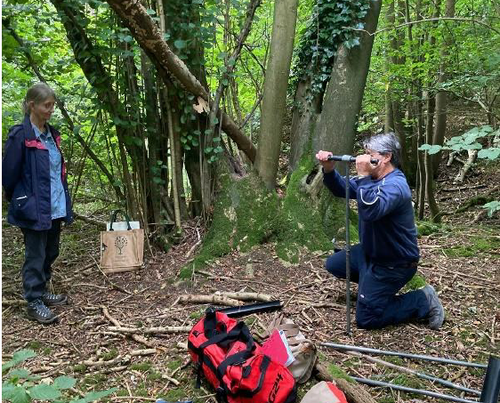
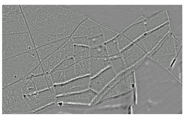
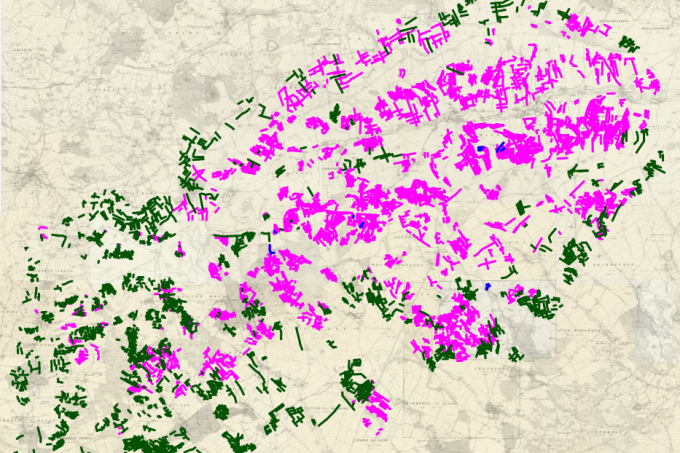
• Skip to main navigation
  • Skip to main content
  • Skip to search form
  • Skip to footer
Chase and Chalke Landscape Partnership logo

Chase & Chalke Landscape Partnership

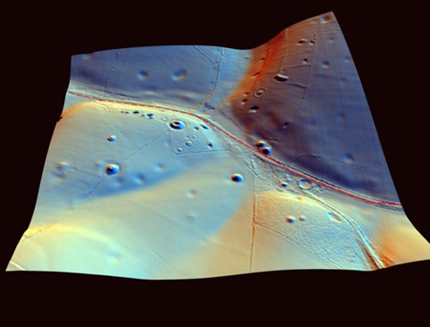
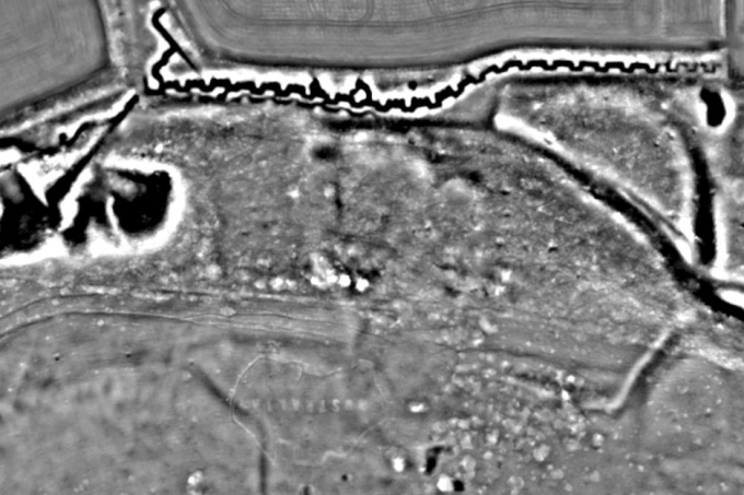
Explore LiDAR datasets from Cranborne Chase

  • About Chase & Chalke
    • Contact
  • Volunteer Hub
  • Learn to use Lidar data
    • Find out more about lidar
    • Training
      • Resource List
  • Project Results
    • Beyond the Map – Volunteer News
    • Potential Features Map
  • Register / Login
  • Skip to menu toggle button

Author: Rebecca Bennett

Preliminary geoarchaeology of the Netton Clump depressions

Posted on: May 11, 2025 Last updated on: May 11, 2025 Written by: Rebecca Bennett Categorized in: chalk pits
— report by Michael J Allen — In August 2024 the Chase Chalke volunteers joined Mike Allen to undertake two days of hand augering to define the nature, character and potentially depth…
Continue reading…

Curious Cursus: looking at the evidence with a new ‘light’

Posted on: November 27, 2024 Last updated on: November 27, 2024 Written by: Rebecca Bennett Categorized in: LiDAR
— by Rebecca Bennett — In August I was asked to give a talk at the fabulous Curious Cursus event, which sadly due to family commitments I couldn’t attend in person. My…
Continue reading…

How many wheelbarrow loads would it take to empty a typical chalk pit?

Posted on: November 4, 2024 Last updated on: November 7, 2024 Written by: Rebecca Bennett Categorized in: LiDAR
— by Steve G — That is a good question and one that is relatively easy to answer if you have access to LIDAR data within a reasonably-featured GIS (Geographic Information System)…
Continue reading…

Obsessed with LiDAR?

Posted on: October 22, 2024 Last updated on: November 7, 2024 Written by: Rebecca Bennett Categorized in: LiDAR
— by Steve G — A word of warning here. Be very careful getting too involved with citizen science projects that involve LiDAR, like for example the excellent “Champions of the Past”…
Continue reading…

Naishes Farm – Revealing History Ancient and Modern

Posted on: October 16, 2024 Last updated on: October 16, 2024 Written by: Rebecca Bennett Categorized in: WWI
— by John Mullin — LiDAR provides us with a new way of seeing history on the ground, often in areas of woodland or scrub where traditional methods of surveying would have…
Continue reading…

Chalk pits mapping project

Posted on: October 8, 2024 Last updated on: November 7, 2024 Written by: Rebecca Bennett Categorized in: chalk pits
— by Rebecca Bennett — As part of the lidar mapping project and field visits, a very large number of regularly spaced pits have been noticed across the Chase & Chalke project…
Continue reading…

Visiting the Chalk Pits at Netton Clump

Posted on: October 7, 2024 Last updated on: November 10, 2024 Written by: Rebecca Bennett Categorized in: chalk pits
— by Yvonne Crossley — I first became interested in LiDAR maps of the Burcombe landscape when I found iron pyrites nodules on a walk around the top of the Punchbowl near…
Continue reading…

Similar but different – LiDAR in Cranborne Chase and the Chilterns

Posted on: October 7, 2024 Last updated on: October 7, 2024 Written by: Rebecca Bennett Categorized in: chalk pits
— by Vivienne Blandford — This is a very broad-brush comment about a landscape led approach which compares the type of archaeological features that have been mapped/visualised by LiDAR on what are…
Continue reading…

some thoughts on chalk pit patterns

Posted on: October 7, 2024 Last updated on: October 7, 2024 Written by: Rebecca Bennett Categorized in: chalk pits
— by Vivienne Blandford & Rebecca Bennett — When considering the nature of the pits we have identified in the LiDAR of the Chase it is useful to compare their pattern and…
Continue reading…

what does a LiDAR volunteer do?

Posted on: October 4, 2024 Last updated on: October 15, 2024 Written by: Rebecca Bennett Categorized in: about the project
— by Mike Bates — LiDAR stands for Light Detection and Ranging. The survey technique uses laser scanners mounted to light aircraft to send thousands of pulses to the ground to record…
Continue reading…
Page: 1 Page: 2 Next page »
Cranborne Chase National Landscape

MORE INFO

Conditions of use
Accessibility
Privacy
Contact us

About Cranborne Chase LiDAR

This digital portal can be accessed from your home at any time. To learn more, click here.

Copyright © 2025 Chase & Chalke LiDAR Portal

  • Facebook
  • Twitter
Back to top of the page
Chase & Chalke Landscape Partnership > Articles by: Rebecca Bennett