When investigating the landscape and looking for traces of past human interaction we want to be able to categorise what we are seeing. In the next section we will discover archaeological feature types such as hillfort, barrow or field system, but the first step to understanding any feature visible in the lidar data is to recognise its form.
Being able to describe the form of a feature enables us to record its presentation independent of a suggested archaeological feature type. It is an important part of the process of recording features from the lidar because it provides evidence for your interpretation and allows re-interpretation at a future date if needed.
Say what you see – how to describe the form of a feature
To describe the physical presentation of a feature in the lidar data we can ask the following questions:
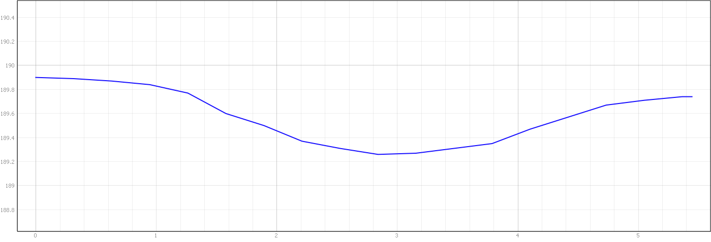
Is the topography positive or negative?
Positive features protrude from the surface like a bank or mound.
Negative features are cut into the surface like a pit or ditch
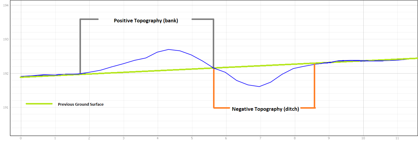
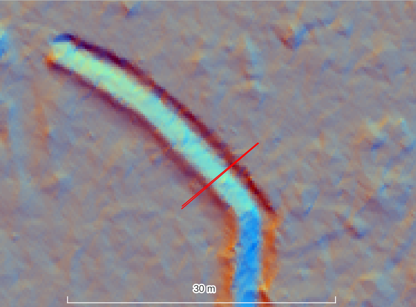
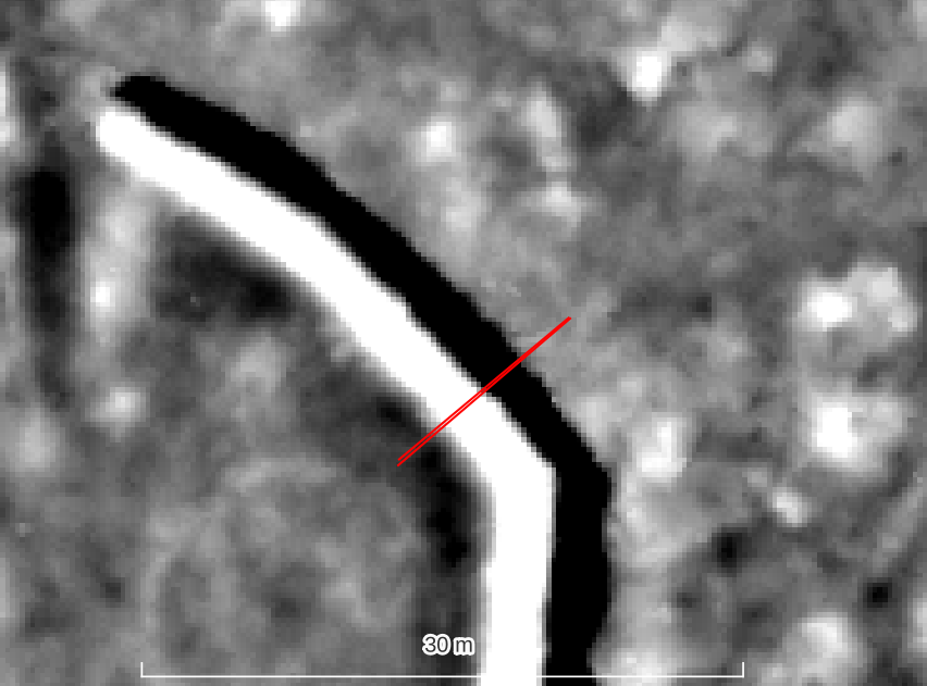
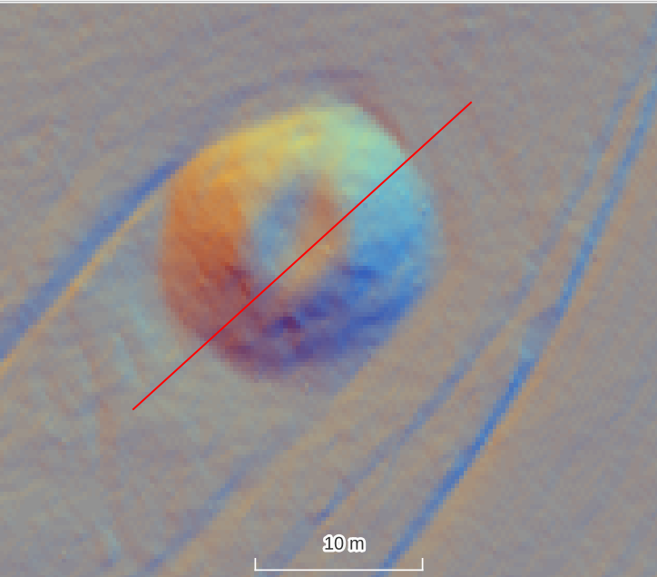
Topographic features may be related to each other as in the ditch and bank above (the ditch material was used to create the adjacent bank). They may be independent as with the examples below.
Negative Topography (pit)
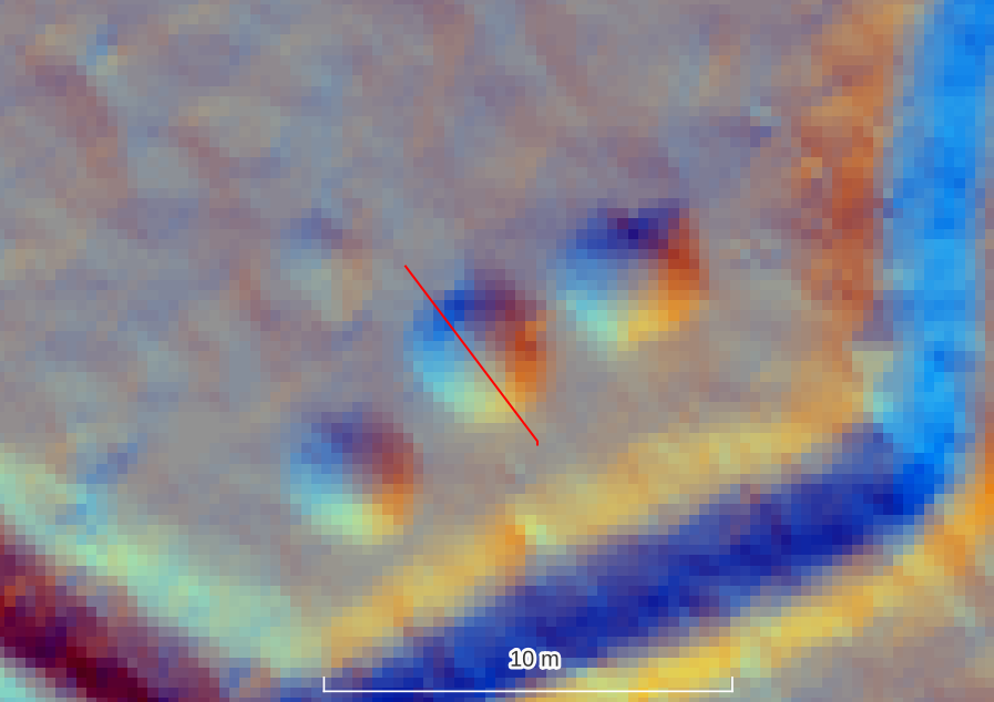
Positive Topography (mound)