Airborne lidar is a survey method that allows us to make highly accurate 3D models of the ground surface. These models show traces of human activity that help us to understand how communities use the landscape in the present and the past.
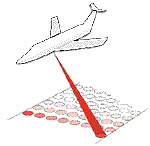
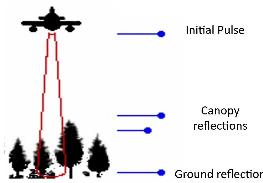
A lidar sensor uses a laser to measure the distance between the aircraft and the ground. By recording millions of these measurements we can create a record of the relative heights of the ground surface. The laser also reflects off trees and buildings, cars, cows and cursus monuments – anything present in the landscape at the time of the survey is recorded.
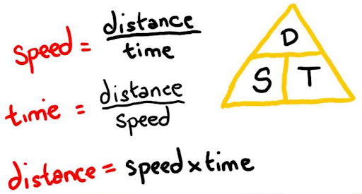
The principle behind lidar survey is simple. If you know the speed something is travelling at and the time it takes to get from A to B, you can calculate the distance between A and B.
In this case we know the speed of the laser (S = Speed of Light), and we can time how long it takes to get from the sensor to the object it reflects from (T) so we can work out the distance (D) between the sensor and the reflecting object.
This is of course an over-simplification. You need to do a lot of clever corrections for the movement of the plane and the real-world location of the aircraft using GPS to get accurate measurements but it gives you a feel for how the technology works.