If what we are most interested in is microtopography then what we really need is a visualisation that removes the big elevation changes in the DTM and leaves only the small scale changes.
The Local Relief Model (LRM) meets this requirement perfectly as it accentuates small scale changes in a clear image where positive features (banks, boundaries) are white and negative features (ditches, pits) are dark.
The images below compare hillshade and the local relief visualisations for the same area at different scales
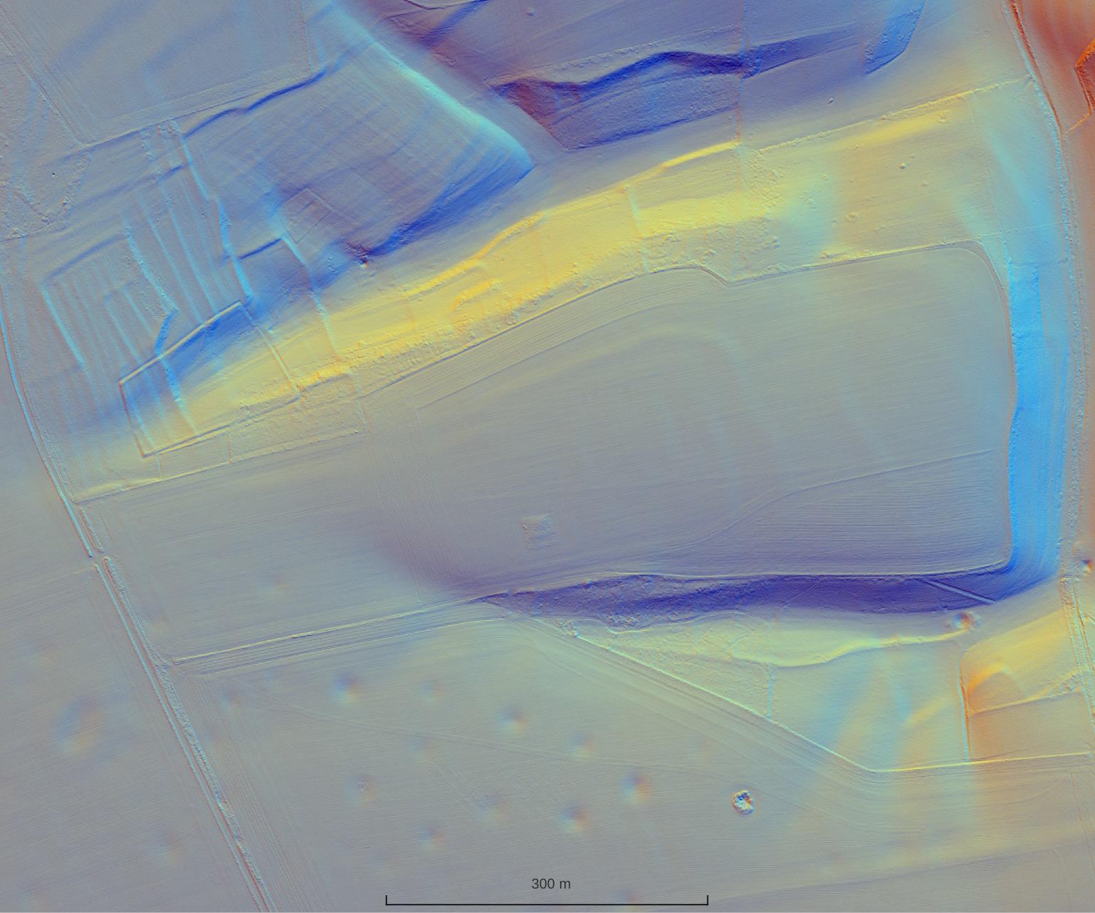
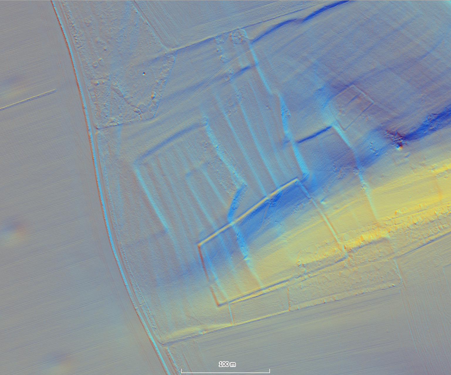
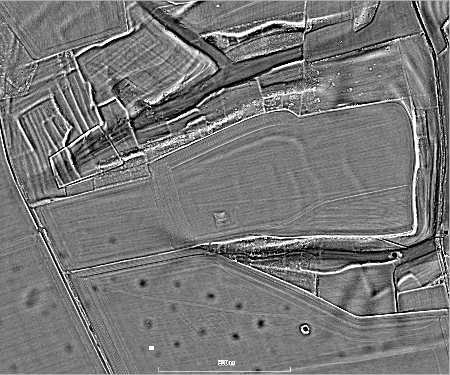
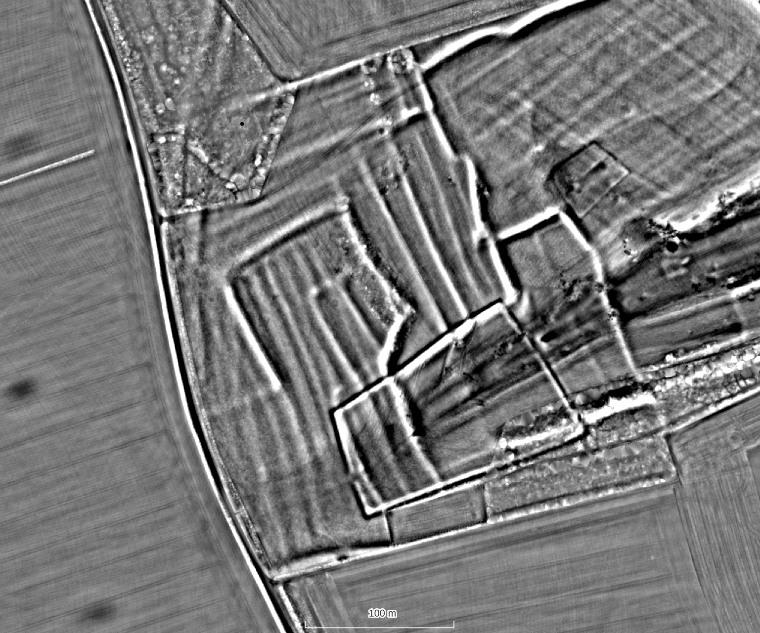
The large scale changes to the landscape are smoothed out by the process of creating the LRM, This means that the microphotography is more prominent but also that the viewer may lose the context of the features in the wider landscape. It is important to use both the hillshade and the local relief model together.
There are many different ways to visualise lidar data to view archaeological features. If you want to find out about these or more details about how the local relief model is created, you can check out our resources section which has links to other examples and publications.