Once you have added the feature data to the record form it’s time to put it on the map. We will do this by drawing a shape around the visible extent of the feature(s) being recorded.
Only one map feature is allowed per record so make sure that the polygon you draw has all the relevant features inside.
Drawing a Polygon Shape
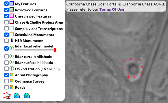
- Zoom and pan the map until your target feature is comfortably at the centre of the window
- Select the draw polygon tool

- Click to start drawing your polygon
- Double click to close the polygon
If you are are happy with the polygon extent it’s time to submit your record.
Changing the Polygon Shape
Please note that you can only re-draw the polygon before you submit the record.

If you would like to redraw your polygon you must delete it by:
- clicking on the select tool (white arrow)
- clicking on your polygon to select it (it will change colour)
- clicking the delete tool
Your map feature will be removed ready for you to re-draw it.