Once you have identified a feature of interest you need to record some details about it in the record form on the left of the map. Below is a description of each piece of information we’d like you to record.
It is best to record the feature data before drawing a boundary around it on the map so that you can continue to freely play with the map layers while typing.
Once you have submitted the record you cannot edit it.
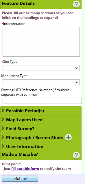
Feature Details
| Description | Record your observations of the feature. Points to include are: – size and shape – topographic form – relationship to other features – notes on land use or preservation Where relevant please note environmental factors that may affect the presentation of the feature in the lidar e.g heavy scrub cover, ploughing, erosion | Use the map measurement tool to collect feature dimensions |
| Site Type | Pick a broad site type from the drop down list. | e.g. Bank (Earthwork) Ditch Enclosure Field Systems Mound Pit/Hollow Routeway Settlement Uncertain / Other |
| Monument Type | Define the site more closely if possible, picking from the drop down list. The options in the list are determined by the Site Type category selected above. | (Routeway) e.g. Drove Road Hollow Way Road Trackway |
| Existing HER Reference Number | Use this field to add existing HER reference numbers for related monuments. | e.g. MWI5920 MDO5594 55889 |
Possible Periods
| Possible Period | Allocate a period to the feature if known. Note that we don’t expect that all features will be given a period, use this only where there is a reasonable analogy to a dated example. | Choose from Prehistoric, Neolithic, Bronze Age, Iron Age, Roman Saxon/Early Medieval, Medieval, Post-medieval, Modern, C20th, Unknown |
Map Layers Used
| Background Layers Used | Check the background layers that were used to identify the feature. | e.g. Lidar Local Relief Model Lidar hillshade (terrain) Lidar hillshade (surface) Historic OS map Aerial Photographs |
Field Survey?
| Site Visit? | Do you think that the interpretation of this feature would be further enhanced by a walkover survey? The Chase and Chalke team will use this information to prioritise field survey so think about what might be gained from ground level observations. | |
| Please detail why: | Use this free text field to record any additional information that might help the review team to understand why you have nominated this feature for field survey. | e.g. western edge of feature unclear due to heavy undergrowth |
Image / Screenshot
| Image | If it enhances your description, you can add an image or screenshot in this section by clicking the green cross. (Most sites identified on the lidar will not need additional images). |  |
User Information
| Recorder Name Recorded Date | These fields are automatically populated as metadata for the record and can’t be edited. The feature will also be given a unique ID number when saved. |
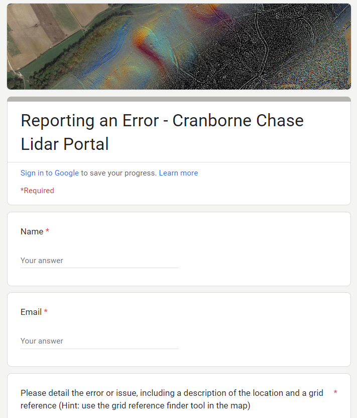
Made a Mistake?
You cannot edit features after you submit them to the map so please report any errors using the link in this section.
Example Records
Below is a sample record created by our core team to help you read the landscape. You can click on any record to view summary data in a pop up window. (Hint: if you don’t see a pop up check that your browser will allow pop-ups from this site).
There are sample records created for a selection of test areas near Chase Woods, Knighton Hill and Martin Down.
Browsing these example records in the map will help you to get a feel for what needs to be recorded.