There are two main categories of evidence that we can see in aerial photographs that represent past human interactions with the landscape: topographical features and proxy indicators.
Topographical Features
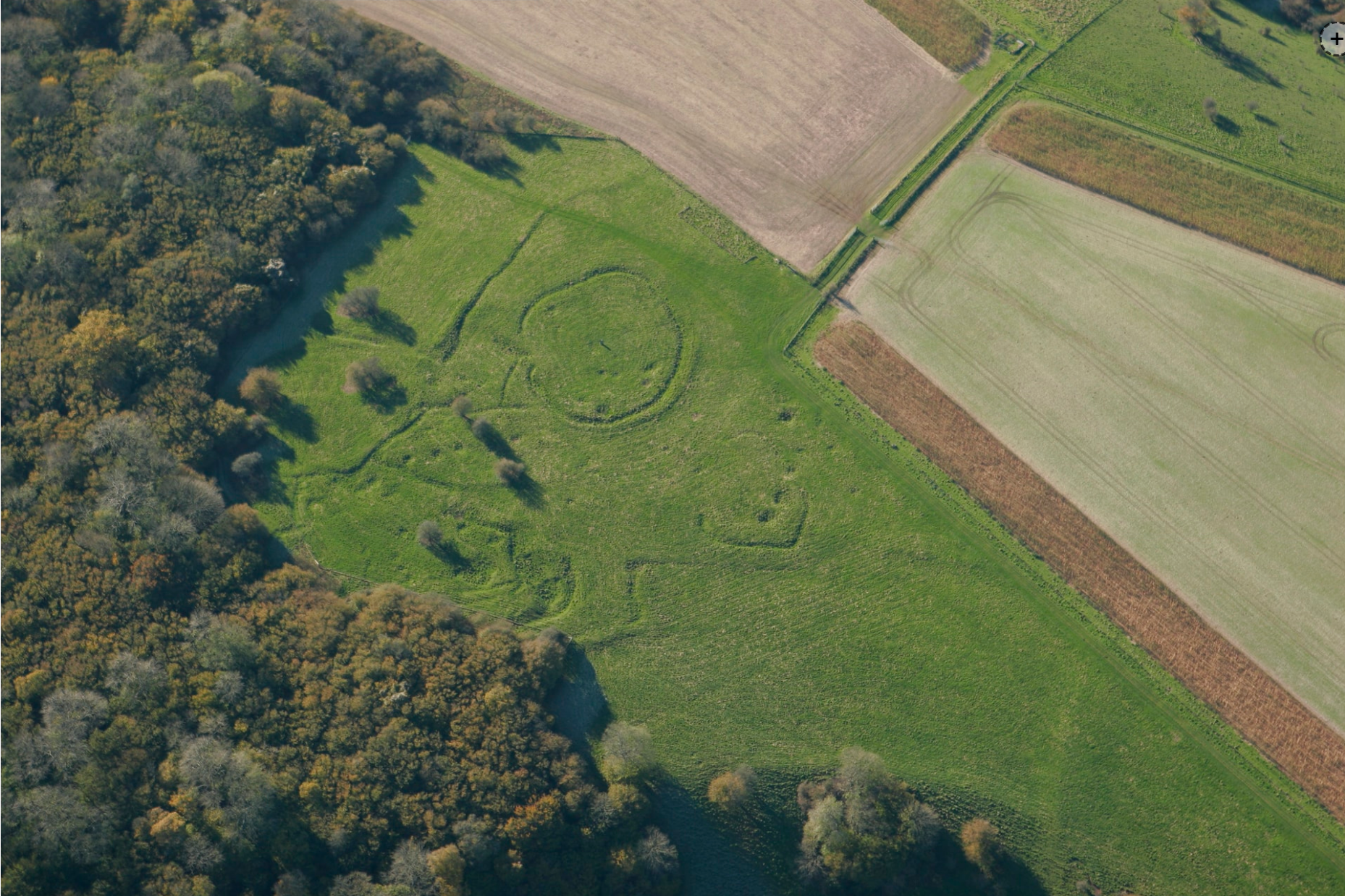
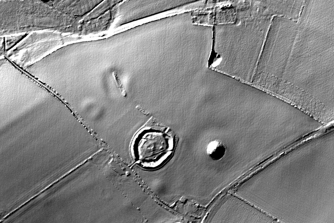
Lots of past human activities left changes to the surface of the land. Think about the ways in which farming, settlement, burial or industrial activity leads to the construction of features like banks, or the extraction of materials creating pits.
Lidar data is very well suited to identifying these features.


Proxy Indicators of Buried Features
In aerial photos we can also identify traces of past landuse through proxy indicators such as changes in soil colour or vegetation growth. In specific conditions, buried features affect the colour or vigour of vegetation above them, resulting in crop marks. Areas where crop marks occur tend to have been affected by ploughing, often leaving no detectable difference in height of the ground surface.
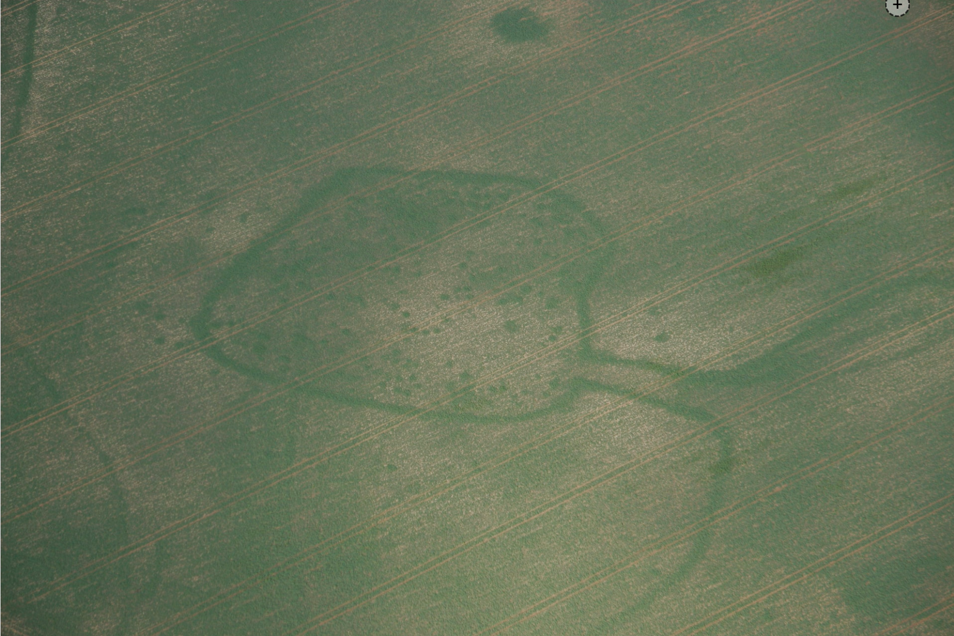
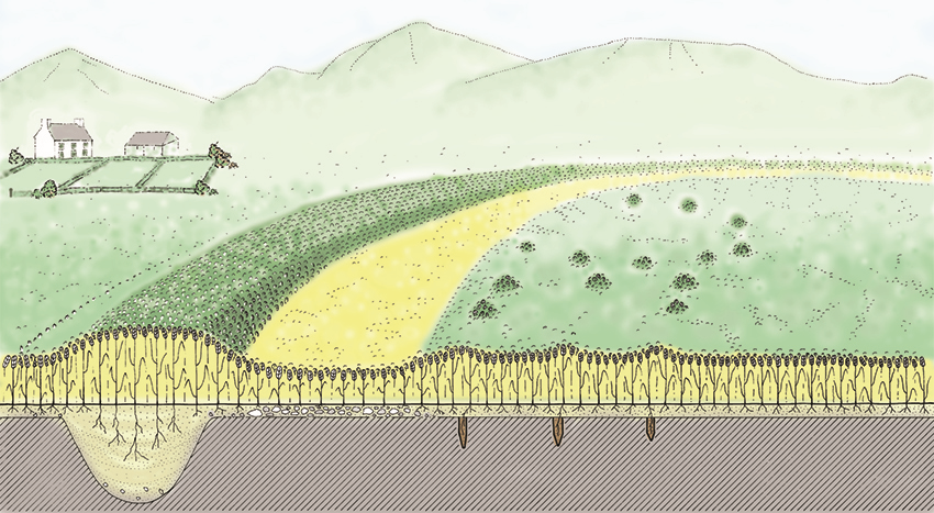
Because lidar survey captures only height information from the ground surface, is it not possible to identify features that are present below the surface or indicated by proxy changes.
Look what we could be missing…
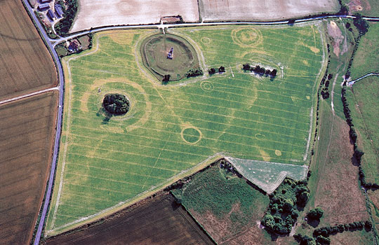
As brilliant as the lidar data is, we need to remember that the archaeological potential of the landscape is much greater that just the upstanding features. Compare these two images of Knowlton, a site famous for both upstanding remains and cropmarks. How many archaeological features are detectable in the crop marks but missing from the lidar data? How much clearer are the ditch and bank features in the lidar image?
Many sources lead to better mapping!
If we use both aerial images and lidar data together we can make better interpretations of the historic landscape. As we will see in the next section, adding the existing historic environment records to our toolkit makes it even better!