As well as the lidar hillshade and local relief model visualisations, the map contains lots of additional information to help you read the landscape. Switch any map layer on by ticking the box beside its name.
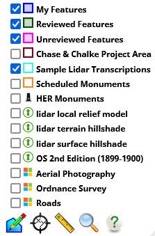
There are three types of information layers; background imagery, data layers, and feature layers.
Background Imagery
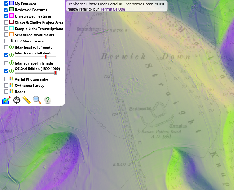
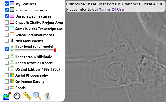
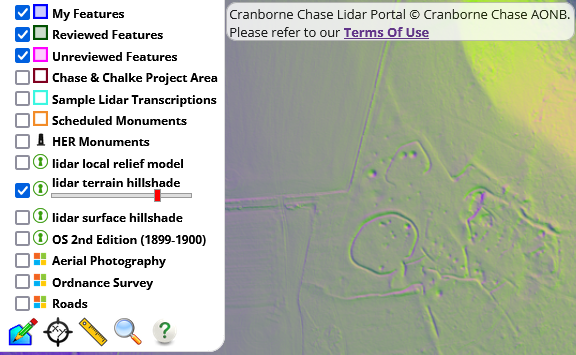
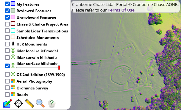
Background layers appear in the order they sit in the layer menu which means that only the top-most layer will be shown at any time. For the three lidar layers and the OS second edition you can adjust the transparency using the slider beneath the layer name to blend it with the layer below.
- Lidar Local Relief Model
- best for subtle microtopography, e.g ploughed features
- Lidar hillshade (terrain)
- shows all vegetation and buildings, good for context)
- Lidar hillshade (surface)
- shows ground only, good for context and microtopography
- OS 2nd Edition (1899-1900)
- Ordnance Survey historic map supplied by the National Library of Scotland
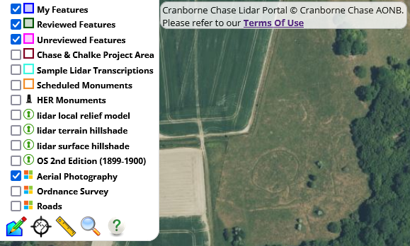
- Aerial photography
- Supplied by Microsoft Bing © Vexel Imaging
- Modern Ordnance Survey Map 1:25,000
- Supplied by Microsoft Bing © Ordnance Survey


Comparing two layers
You can use the keyhole tool to compare any two basemaps. Click the icon to open the window to see the layers adjacent to each other. The keyhole window can be moved and resized to change the view. Watch the video below to see how

Data Layers
Data layers contain information about features that have already been recorded. We use polygons and points to represent these features and provide url links to their full record in external websites.
- Sample Lidar Transcriptions
- shows features transcribed in four sample areas of the Cranborne Chase lidar by our specialist
- clicking any feature opens its record
- Historic Environment Record
- shows contains combined point data from Dorset, Hampshire and Wiltshire HERs)
- clicking any feature on this layer links to the full monument record in a new tab
- Scheduled Monuments
- shows the extent of scheduled monuments from Historic England
- clicking a feature on this layer links to the full monument record in a new tab


Clicking on any feature in these layers gives you access to more information. Click the hyperlink in the feature pop up to open the HER and Scheduled Monument records


Feature Layers
Feature layers contain the transcriptions made by the volunteer community using the Cranborne Chase Portal
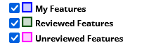
- My Features
- shows a filtered layer containing only the features you have created
- Unreviewed Features
- shows a layer containing all features from the community that have not yet been reviewed by the core team
- Reviewed Features
- shows a layer containing all features from the community that have been reviewed by the core team